Add Republic As Your Trusted Source
Add Republic As Your Trusted Source
Advertisement
Updated September 27th 2025, 14:52 IST
Historic Milestone: NASA-ISRO NISAR Satellite Captures First Radar Views of Earth’s Surface
The NASA-ISRO NISAR satellite has sent its first radar images of Earth’s surface, showcasing advanced radar technology and promising new capabilities in Earth observation, disaster response, agriculture, and climate monitoring.
The NASA-ISRO Synthetic Aperture Radar (NISAR) satellite has successfully sent its first radar images of Earth’s surface, marking an important step in the joint mission between NASA (National Aeronautics and Space Administration) and ISRO (Indian Space Research Organisation). The mission aims to provide detailed information about our planet and support various scientific and practical applications.
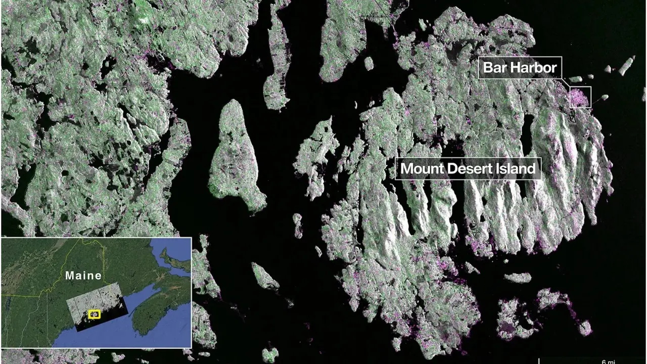
Launched by ISRO on July 30, 2025, NISAR uses advanced radar technology to capture images of Earth’s surface with high precision. On August 21, the satellite’s L-band radar system, developed by NASA’s Jet Propulsion Laboratory, captured images of Mount Desert Island on the Maine coast. In the images, dark areas represent water, green areas indicate forests, and magenta shows hard surfaces such as buildings and bare ground.

The town of Bar Harbor is clearly visible, demonstrating the radar’s ability to distinguish different types of land cover.
Two days later, on August 23, NISAR captured images of Forest River in North Dakota, showing wetlands, forests, farmland, and circular irrigation plots. These images highlight the satellite’s capability to differentiate between fallow fields and active crops like corn and soybeans.
NISAR is unique because it combines two radar bands: NASA’s L-band and ISRO’s S-band. This dual radar system allows the satellite to gather comprehensive data about Earth’s surface. It orbits the Earth every 12 days from an altitude of 747 kilometers and can detect features as small as 5 meters.
The information provided by NISAR will be useful in many areas, including disaster response for events like floods, landslides, and earthquakes, agricultural monitoring to support food security, tracking climate change and ecosystems, and helping in urban planning and infrastructure management.
NASA Acting Administrator Sean Duffy said that NISAR’s first images show what can be achieved when countries work together. The mission will officially begin full science operations in November 2025 and is expected to bring new advancements in Earth observation and environmental monitoring.
This joint NASA-ISRO mission is an example of international cooperation benefiting science and society by improving our understanding of the planet we live on.
Published September 27th 2025, 14:52 IST